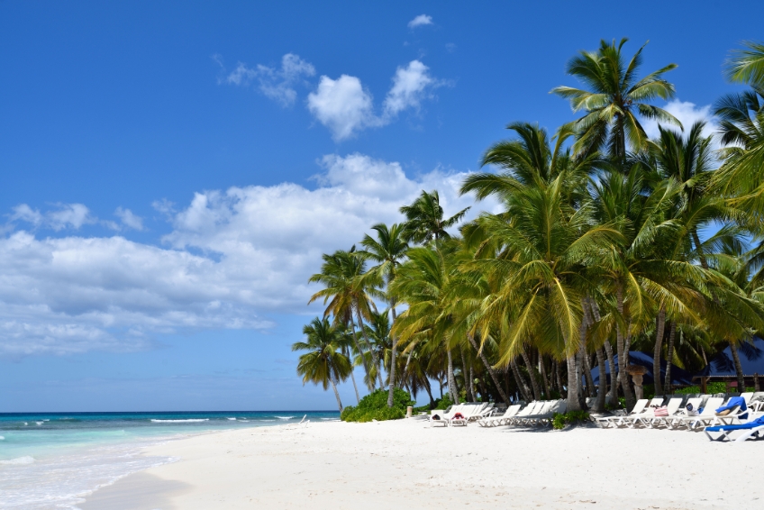
About The Caribbean
The Caribbean region is a geographically diverse area located in the western part of the Atlantic Ocean, south of Florida and the Gulf of Mexico, east of Central America, and north of South America. It is made up of more than 7,000 islands, islets, and reefs, including the Greater Antilles and the Lesser Antilles, as well as mainland territories such as Mexico, Belize and Guyana. Below is our Caribbean Map and extensive guides to numerous Caribbean islands.
Caribbean Map

CONTENTS

CARIBBEAN MINI GUIDES
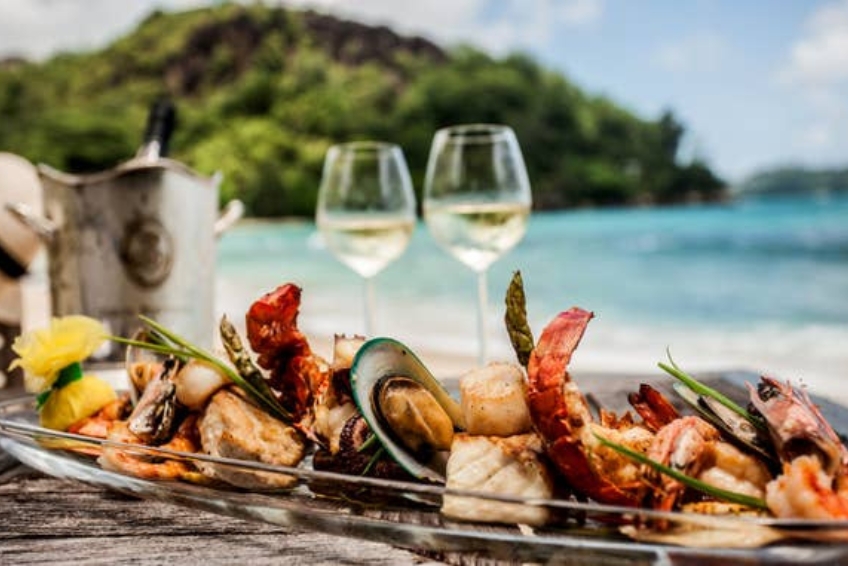
Islands, Beaches, Food & More
Hotel guides, Restaurant guides, Things To Do guides and so much more. All the info you need is all right here at your fingertips. Enjoy!
ANTIGUA
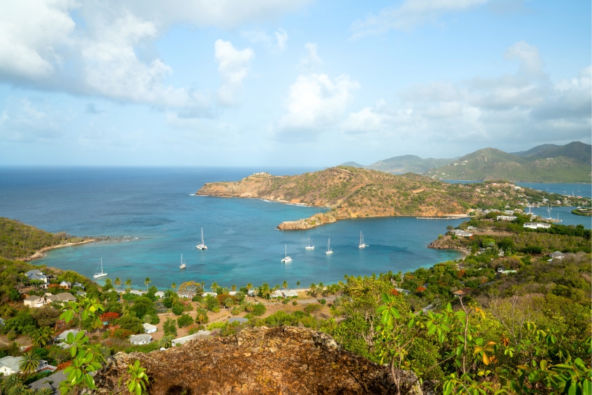
Antigua Visitors Guide
The island of Antigua holds a special place in our hearts. It’s a place where one can access luxurious amenities and STILL find numerous places to get away from it all! Here is some basic info to get you started and many of the best things to do in Antigua.

Antigua Hotel Guide
Antigua has a special blend of all the comforts of the 21st century mixed with all the mystique of the pirate era. Visitors can relax on the beach, snorkel, zipline and more. Use this guide to Antigua hotels to pick your perfect relaxation base.

Antigua Restaurant Guide
Welcome to beautiful Antigua! This stunning Caribbean Island has been a favorite of holidaymakers from around the world for years, with its relaxed culture and gorgeous seafood just two of the biggest draws for travelers looking to embrace the slower side of life.

The Best Antigua All Inclusive Resorts
Whether you’re searching for family relaxation or some romance, each of these all-inclusive resorts in Antigua will deliver, with a dash of Caribbean luxury, and the perfect setting for your dream tropical vacation.
ARUBA
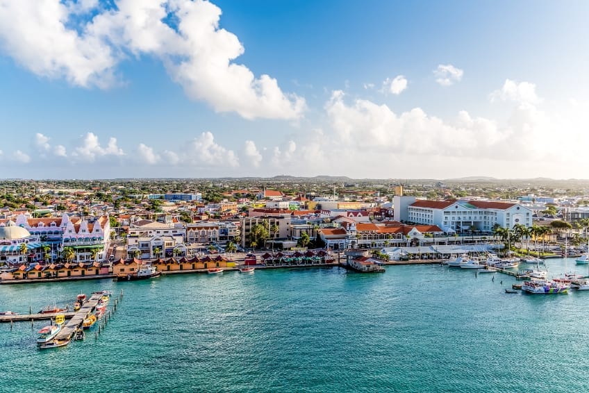
Aruba Visitors Guide
Aruba is a fantastic mix of cultures, natural beauty and delicious cuisine. Whether you want to relax on the beach sipping cocktails or explore the history of the island, Aruba has something for everyone. Come find out just what this tropical paradise has to offer!

Aruba Hotel Guide
Located in the southern Caribbean, Aruba is an island paradise with idyllic year round weather. So, regardless of whether you are looking to go snorkeling, shopping or just relax, there’s a place for everyone. Here are the best hotels in Aruba!

Aruba Restaurant Guide
Aruba is a small slice of paradise in the Caribbean and is filled with various restaurants and cuisine options to suit any traveler. From budget-friendly ‘mom and pop’ restaurants to high-end mouthwatering dishes, it’s hard to go hungry in Aruba.

Aruba All Inclusive Resorts Guide
Aruba has a wide selection of excellent all inclusive resorts including 5-star luxury, family friendly, adults only and budget friendly options. Here is our guide to the best Aruba all inclusive resorts!
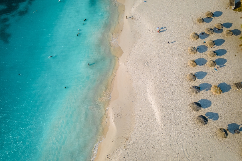
Aruba Beaches Guide
Aruba beaches are some of the best in the world. The white sand of Aruba beaches is famous and the Caribbean waters are always clear which makes it easy to see tropical fish and other marine life. Here are the best beaches in Aruba!
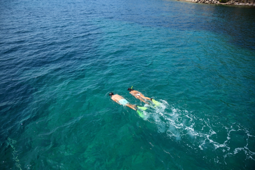
Aruba Snorkeling Guide
From crystal clear waters and exotic sea life to vibrant reefs and fascinating shipwrecks, Aruba offers unforgettable aquatic adventures for all experience levels. Our guide will give you an insider’s look at the best snorkeling sites in this stunning Caribbean paradise.
BAHAMAS

Bahamas Visitors Guide
The Bahamas has something for everyone, whether you’re a single wanting to get away, a couple needing quality time to connect, or a family seeking adventure. With 700 islands and 2,500 cays, the opportunities are endless!
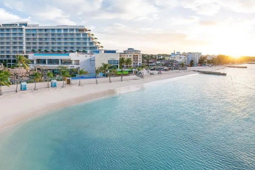
Bahamas Hotel Guide
The Bahamas are a beautiful stretch of islands in the northern Caribbean. With white sand beaches, turquoise water and numerous islands to choose from, there's something for everyone. Here are some of the best hotels in the Bahamas.
Bahamas Restaurant Guide
The Bahamas are a favorite Caribbean travel destination for American vacationers, and it’s easy to see why. With plentiful sunshine, beautiful scenery, and incredible restaurants everywhere, there is something for everyone in this tropical paradise.

The Best Bahamas All Inclusive Resorts
The Bahamas has everything you could desire for a perfect tropical getaway; a warm climate, sparkling blue waters and friendly locals. Here are the best all-inclusive resorts in the Bahamas that you should definitely look into.

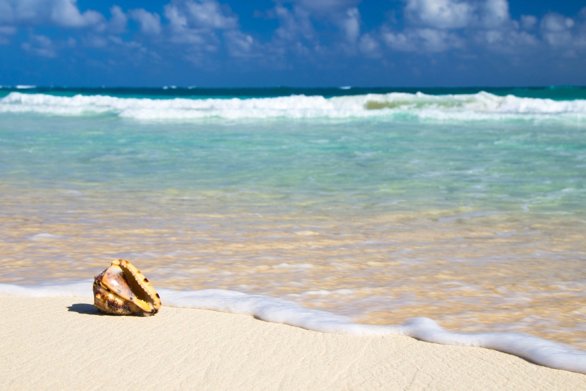
Bahamas Beaches Guide
The Bahamas is known for having some of the most beautiful beaches in the world. The gorgeous turquoise waters and warm ivory sand can even be seen from space! Here is our guide to the best beaches in the Bahamas to enjoy this tropical paradise.
CAYMAN ISLANDS

Cayman Islands Visitors Guide
Whether you want to enjoy the turquoise water of the Caribbean, explore the wonders of nature, or shop till you drop, the Cayman Islands will excite everyone. From the white sand beaches to the duty-free shopping, you are sure to enjoy every minute in the Caymans.

Cayman Islands Hotel Guide
The Cayman Islands are one of the most beautiful locations for a sun-soaked getaway – but what is a holiday without quality accommodation? No matter your budget, we’ve rounded up some of the best Cayman Islands hotels for you to enjoy during your stay.
Cayman Islands Restaurant Guide
Known for its beautiful shores and friendly locals, the Cayman Islands combine wild adventure, stunning scenery, and delicious food. Here is our guide to the best Cayman Island restaurants you'll have to check out on your visit!

The Best Cayman Islands All Inclusive Resorts
Welcome to the ultimate guide to Cayman Islands all inclusive resorts! Whether you’re looking for a family-friendly resort or a romantic adults-only retreat, we’ve got you covered with this list of the best all inclusive resorts in the Cayman Islands.
Cayman Islands Beaches Guide
The Cayman Islands has some of the best beaches in the Caribbean Sea. From snorkeling to relaxation to swimming, the Cayman Islands has it all. Here are the 10 best Cayman Islands beaches to check out on your visit!
DOMINICAN REPUBLIC
Dominican Republic Visitors Guide
The Dominican Republic is known for gorgeous beaches, resorts, and rich cultural history. As one of the most diverse destinations in the Caribbean, you’ll find a bit of everything in the Dominican Republic. Here is our guide to the best of the Dominican Republic.
Dominican Republic Hotel Guide
Home to fantastic rum, beautiful beaches, and an abundance of national parks, reserves and sanctuaries, the Dominican Republic offers a beautiful experience to all those who visit. Here is our guide to the best hotels in the Dominican Republic!

Dominican Republic Restaurant Guide
As a pristine and beachy oasis, the Dominican Republic is perfect for a budget-friendly tropical getaway. From local Caribbean dishes to authentic Italian cuisine, the food selection is delicious and diverse. Here are some of the best restaurants in the Dominican Republic!

The Best Dominican Republic All Inclusive Resorts
The Dominican Republic is known for its picturesque beaches, lush jungles, rich cultural heritage and friendly locals. Here is our list of the best Dominican Republic all inclusive resorts to make your visit to the Dominican Republic incredible.
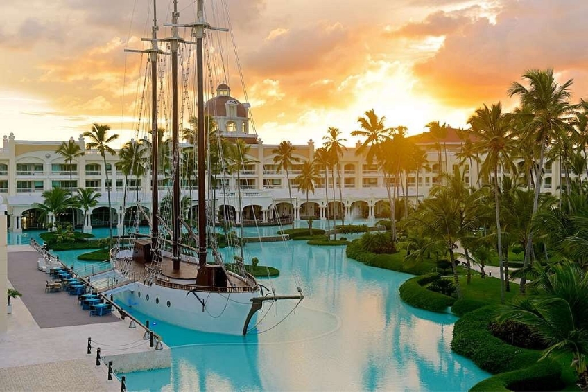
Punta Cana Visitors Guide
The sugary white sands of Punta Cana make it a favorite of those who seek fun in the sun in the Dominican Republic. Enjoy delicious Caribbean cuisine and explore the jungle in this sunny hot spot. Come relax in paradise in Punta Cana.

Punta Cana Hotel Guide
Punta Cana is a sun drenched beach town in the Domincan Republic that offers plenty of hotel choices, no matter your budget. Find out what hotel is the best fit for you by using our Punta Cana hotel guide.
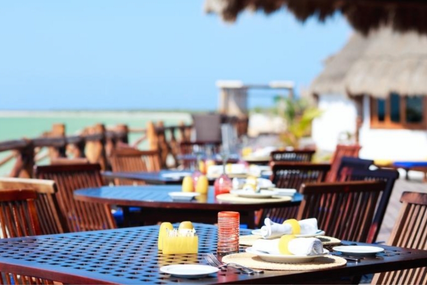
Punta Cana Restaurant Guide
Punta Cana is a tropical paradise in the Dominican Republic. Any trip to Punta Cana would not be complete without a tour of the fantastic restaurant scene. Find out where to eat in Punta Cana with a guide to the best Punta Cana restaurants.
Punta Cana All Inclusive Resort Guide
As one of the Dominican Republic’s premiere resort destinations, it’s no wonder that travelers flock to Punta Cana and its endless miles of beaches. Find your ideal vacation getaway with our list of the best Punta Cana all inclusive resorts.

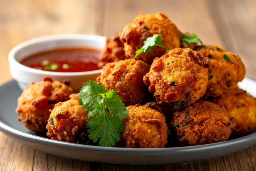
Dominican Republic Food Guide
Dominican Republic foods combine distinct flavors and ingredients from Taino, Spanish, and African influences. If you are in this country or are planning to visit it, here is a list of the best dishes and Dominican Republic food to try.
The Best Dominican Republic Beaches
The Dominican Republic is located on the island of Hispaniola and has some of the best beaches in the Caribbean. Whether you are looking for quiet and secluded or lively and fun, the Dominican Republic has a beach for everyone.

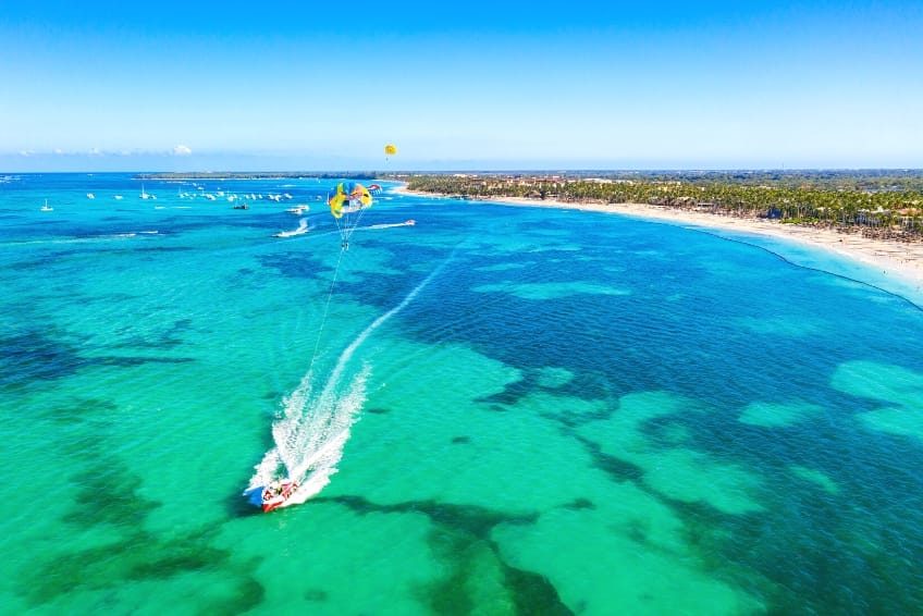
The Best Beaches In Punta Cana
Whether you are looking for calm waters, white sands lined by palm trees, or the best snorkeling on the island, Punta Cana has the perfect beach for you. Here are our top 8 beaches in Punta Cana.
JAMAICA
Jamaica Visitors Guide
Jamaica is a famous Caribbean destination and for good reason. From clear turquoise waters to white sand beaches, lush forests to reggae music, there is something for everyone in Jamaica. Here is our guide to the best of Jamaica.

Jamaica Hotel Guide
Jamaica’s lush rainforests, stunning mountains, and reef lined beaches make this Caribbean nation an island paradise. Known as the home of rhythm and sway, Jamaica offers a kaleidoscope of colors and experiences. Here is our guide to the best hotels in Jamaica!

Jamaica Restaurant Guide
Known for its relaxed vibes and vibrant music scene, Jamaica is one of the best choices for those looking for a laid-back getaway. From bbq street stalls to beachside dining, there is a Jamaica restaurant for everyone on this island paradise.

The Best Jamaica All Inclusive Resorts
Welcome to the ultimate guide to Jamaica all inclusive resorts! Whether you’re looking for a family-friendly resort or a romantic adults-only retreat, we’ve got you covered with this list of the best all inclusive resorts in Jamaica!

Jamaica Waterfalls Guide
Jamaica is home to some of the most famous waterfalls in the Caribbean. From towering cascades to gentle streams, there’s a waterfall for every taste. Here is our guide to the best waterfalls Jamaica has to offer.

Jamaica Beaches Guide
Jamaica has everything from secluded coves to wide stretches of powdery sand. Whether you’re looking for a secluded getaway or an action packed beach vacation, you’ll want to visit one of these ten best beaches in Jamaica.
PUERTO RICO
Puerto Rico Visitors Guide
Puerto Rico is an intoxicating combination of tropical, meets a bygone era. This beautiful island has pristine beaches, excellent dining and vibrant nightlife. See what’s waiting for you in Puerto Rico with its perfect blend of charm and adventure!

Puerto Rico Hotel Guide
Whether you are looking to relax on a beach with your favorite rum drink or take a hike through the forest searching for waterfalls, Puerto Rico has it all. Here is our guide to the best hotels in Puerto Rico!

Puerto Rico Restaurant Guide
Puerto Rico has something to offer every traveler. Its sun-filled beaches, traditional cuisine and rum-filled nightlife are the biggest attractions for most tourists to this beautiful island. There are food options for everyone here, whether you love pork, seafood, or margaritas.

The Best Puerto Rico All Inclusive Resorts
Are you ready for that Puerto Rico getaway? This guide to the best all inclusive resorts in Puerto Rico will help you to choose the perfect resort for your relaxation escape.

Puerto Rico Bioluminescent Bay Guide
There are three incredible bioluminescent bays in Puerto Rico that shouldn't be missed. They are a unique attraction, and visiting them is the perfect nighttime adventure. Here's a guide to visiting these bioluminescent bays on your next trip to Puerto Rico.
ST. BARTS
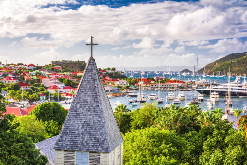
St. Barts Visitors Guide
This French speaking island offers a luxurious vibe with a Caribbean charm. Catering to the wealthy, St. Barts is one of the best places to spend a day on a yacht, snorkel in the crystal blue water, or just relax at one of the deluxe resorts.

St. Barts Hotel Guide
Home to designer boutiques, luxury yachts, sandy beaches, and European flare, there’s a reason that St. Barts (also known as St. Barths) is a premier Caribbean destination. Impressive views, glistening bays, and luxury resorts mean that your stay will be nothing short of remarkable.

St. Barts Restaurant Guide
Located in the Caribbean Sea, St. Barthelemy, or St. Bart’s, is a go-to destination for luxury holidaymakers looking to blow off steam. The cuisine choices are expansive with something delicious for everyone. Here are some of the best restaurants in St. Barts!

The Best St. Barts All Inclusive Resorts
St. Bart’s offers a refined and intimate atmosphere for a bevy of high-class travelers, including many celebrities. We’ve compiled the top six resorts in St. Bart’s for various budget types that you should check out.
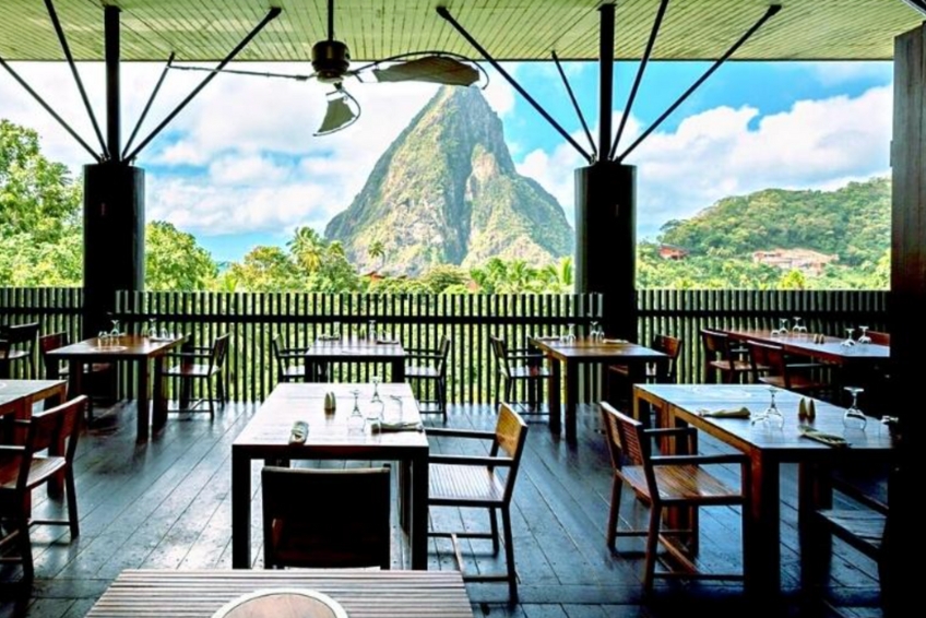
ST. LUCIA

St. Lucia Visitors Guide
Nestled in the Lower Antilles is the beautiful green Caribbean island of St. Lucia. Famous for its towering Pitons, St. Lucia is home to jungles, pristine beaches, endless activities and more. Here is our guide to the best of St. Lucia.

St. Lucia Hotel Guide
St. Lucia is a picture perfect island in the northern Caribbean. With towering green Pitons, white sand beaches and turquoise water, there's something for everyone. Here are some of the best hotels on St. Lucia.
St. Lucia Restaurant Guide
St. Lucia has a wide variety of restaurant and cuisine options available. From Castries to Soufriere, visitors can sample international cuisine as well as local dishes and fresh seafood aplenty. Here is our guide to the best restaurants in St. Lucia.

The Best St. Lucia All Inclusive Resorts
St. Lucia is a nature lover's dream with towering green Pitons, wild jungles, beautiful beaches and warm Caribbean waters. Here are 5 of the best all-inclusive resorts in St. Lucia that you should definitely look into.
TURKS & CAICOS
Turks And Caicos Visitors Guide
Welcome to Turks and Caicos, an archipelago of 40 islands and cays in the heart of the Caribbean Sea. With stunning turquoise waters, pristine beaches, and a laid-back island vibe, it’s the perfect destination for a tropical getaway. Here is our guide to the best of Turks & Caicos.

Turks and Caicos Hotel Guide
Turks and Caicos is a beautiful stretch of islands in the northern Caribbean. With white sand beaches, turquoise water and numerous islands to choose from, there's something for everyone. Here are some of the best Turks and Caicos hotels for your visit.

Turks and Caicos Restaurant Guide
Turks and Caicos may be small, but the depth and breadth of dining opportunities would make you think otherwise. From quick eats to fine dining, Latin favorites to European delights, whatever you are craving, you will find it here. Buen Provecho!

Turks and Caicos All Inclusive Resorts Guide
Turks and Caicos has everything you could desire for a perfect tropical getaway; a warm climate, sparkling blue waters and friendly locals. Here are 7 of the best all-inclusive resorts in Turks and Caicos that you should definitely look into.

Turks And Caicos Beaches Guide
The waters in the Turks and Caicos are calm, warm, and crystal clear providing some of the best beaches in the world. Pack your sunblock and use this guide to the best beaches in the Turks and Caicos to plan your perfect getaway.
U.S. VIRGIN ISLANDS
U.S. Virgin Islands Visitors Guide
Looking for a Caribbean destination that offers the perfect blend of natural beauty, adventure, and relaxation? Look no further than the U.S. Virgin Islands! Here is our guide to the best of the USVI.

U.S. Virgin Islands Hotel Guide
The three islands that make up the US Virgin Islands may be small but they are mighty. Each one has its own personality and special traits that make it unique and worth a visit. In our US Virgin Islands Hotel Guide we explore the best hotels in the US Virgin Islands.
U.S. Virgin Islands Restaurant Guide
From little St. John to bustling St. Thomas and on down to St. Croix, the options for restaurants and dining are plentiful in the US Virgin Islands. Here is our guide to the best restaurants in St. John, the best restaurants in St. Thomas and the best restaurants in St. Croix.

The Best U.S. Virgin Islands All Inclusive Resorts
The U.S. Virgin Islands has everything you could desire for a perfect tropical getaway; a warm climate, sparkling blue waters and friendly locals. Here are the best St. Thomas, St. John and St. Croix all inclusive resorts that you should definitely look into.

US Virgin Islands Beaches Guide
From awe-inspiring blue waters and beautiful white sands, to pristine shorelines within national parks, US Virgin Islands beaches are some of the best in the Caribbean. Pack your swimsuit and use this guide to the best beaches in the US Virgin Islands.